


Portions of Illinois were greeted with severe weather, cooler temperatures and even snow as the calendar flipped to April.
Illinois State Climatologist Trent Ford said a series of storm systems in the first week of the month dumped up to 3 inches of rain on the south-central region and snow in the north. In some areas precipitation was accompanied by strong winds, tornadoes and hail.
“It was expected that severe weather would be quite widespread,” he told FarmWeek. “So, I suppose the good news is we didn’t see quite the damage that a big storm like that could bring.”
Prior to the weather shift, USDA reported the first corn and soybean fields of the season had been planted, but Ford said he would be surprised to see much planting progress next week.
“Once you get out of southern Illinois, conditions aren’t great. It’s been an early start in some parts of the state, but I’m not optimistic that everybody’s going to be able to start 2-3 weeks earlier than they normally would,” Ford said.
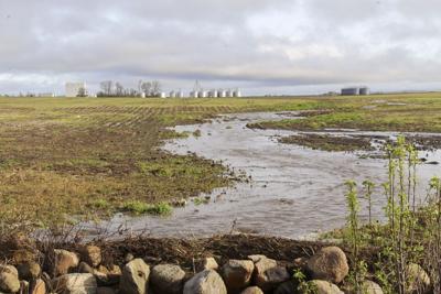
He said the cool, wet conditions will put field work on hold.
“I saw white caps on standing water in a field outside of Champaign because of the wind,” he said. “So, it’s going to take a little while for that water to drain out, and the cooler temperatures are going to pause that for a little while as well.”
But Ford said that pattern won’t last long.
“It looks like warm air is moving in this next week and the 8-to-14-day outlook also points to better chances of warmer than normal conditions with near normal precipitation for the state.”
And that trend is expected to continue through April and May.
“I don’t foresee a lot of widespread delays as far as fieldwork. The outlooks are still favorable for timely planting,” Ford said.
The availability of planting windows is harder to predict, he noted.
“If we see another two or three big systems before the end of April, then we may be looking at some tighter timelines, but right now there’s not a strong indication that folks will have to jump at that opportunity,” the climatologist said.
According to USDA, 38% of topsoil moisture and 42% of subsoil moisture in the state was considered short to very short as of March 31, so recent precipitation should be beneficial ahead of planting.
“We’re going to see some runoff, but looking at the amount of standing water in fields right now, we’re definitely getting some of that in the ground,” Ford said.
He said soil that is 20 to 60 inches deep is a bit drier than normal for this time of year. “This water that is able to infiltrate is going to make it down there and that’s going to be helpful for the summertime if we do go into a dry pattern.”
Ford said far southern and far western Illinois missed out on most of the recent rain, which is notable since those areas remain in moderate drought according to the U.S. Drought Monitor. “It’s actually pretty incredible how the heavier rain bands bent themselves around those areas.”
But Ford said recent precipitation along the Illinois River could help improve Mississippi River levels, as those are still well below streamflow.
“Starting this low does not give a lot of confidence that we will avoid low flow issues in the fall,” he said. “So having the Illinois River at least contribute a significant amount of that flow into the Mississippi helps boost that a little bit and maybe gets us closer to where we typically are this time of the year.”